साँचा:Infobox Indian Jurisdiction/Sandbox

मुक्त ज्ञानकोश विकिपीडिया से
नेविगेशन पर जाएँ खोज पर जाएँ

This is the sandbox for the साँचा:tl template. Please test all proposed non-trivial changes here before updating the live template.

साँचा:template doc page transcluded
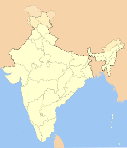


Proposed
  ?سرینگر
Srinagar
Jammu and Kashmir • India
Nickname: Paradise on Earth
View of Srinagar and Dal Lake
Map indicating the location of Srinagar
Location of Srinagar
Coordinates: साँचा:coord
Time zone IST (UTC+5:30)
Area
Elevation

साँचा:m to ft
Climate
Precipitation
Temperature
• Summer
• Winter
ETh (Köppen)
साँचा:mm to in

• 22 °C (72 °F)
• 4 °C (39 °F)
Distance(s)
• From Delhi
• From Mumbai

• ८७६ km NW (land)
• २,२७५ km NE (land)
Region Kashmir
District(s) Srinagar
Population
Density
Metro
Sex ratio
Literacy rate
८,९४,९४०[१] (2001)
साँचा:pop density km2 to mi2
• ९,७१,३५७[१]
• 1.17
• 59.18%
Language(s) Kashmiri, Urdu
Mayor Ghulam Mustafa Bhat[२]
Settled 3rd century BCE
Codes
Pincode
Telephone
UN/LOCODE
Vehicle

• 190 001
• +0194
• INSXR
• JK
Website: www.srinagar.nic.in

साँचा:coord

Current
Srinagar
سرینگر
Paradise on Earth
—  capital  —
View of Srinagar and Dal Lake
Map of Jammu and Kashmir with Srinagar marked
Location of Srinagar
समय मंडल: आईएसटी (यूटीसी+५:३०)
देश साँचा:flag
क्षेत्र Kashmir
राज्य Jammu and Kashmir
ज़िला Srinagar
Settled 3rd century BCE
Mayor Ghulam Mustafa Bhat[१]
जनसंख्या
घनत्व
महानगर
८,९४,९४०[२] (साँचा:as of)
साँचा:convert
• ९,७१,३५७[२]
लिंगानुपात 1.17 /
साक्षरता 59.18%%
आधिकारिक भाषा(एँ) Kashmiri, Urdu
क्षेत्रफल
ऊँचाई (AMSL)
१०५ कि.मी² (४१ वर्ग मील)
साँचा:m to ft
जलवायु
वर्षा
तापमान
• ग्रीष्म
• शीत
ETh (कॉपेन)
साँचा:legend0

साँचा:legend0
साँचा:legend0
  साँचा:collapsible list
  साँचा:collapsible list
आधिकारिक जालस्थल: www.srinagar.nic.in
साँचा:collapsible list


  ?Gampalagudem
Andhra Pradesh • India
Coordinates: साँचा:coord
Time zone IST (UTC+5:30)
Area
Elevation

साँचा:m to ft
District(s) Krishna
Subdistrict Gamaplagudem Mandal