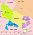
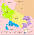
चित्र:Up-subregions2.svg
नेविगेशन पर जाएँ
खोज पर जाएँ


पूर्वावलोकन PNG का आकार SVG फ़ाइल: ५७२ × ५९९ पिक्सेल अन्य resolutions: २२९ × २४० पिक्सेल | ४५८ × ४८० पिक्सेल | ७३३ × ७६८ पिक्सेल | ९७७ × १,०२४ पिक्सेल | १,९५४ × २,०४८ पिक्सेल | २,४०० × २,५१५ पिक्सेल ।
मूल फ़ाइल (SVG फ़ाईल, साधारणत: २,४०० × २,५१५ पीक्सेल्स, फ़ाईलका आकार: २४२ KB)
फ़ाइल का इतिहास
फ़ाइलका पुराना अवतरण देखने के लिये दिनांक/समय पर क्लिक करें।
| दिनांक/समय | अंगूठाकार प्रारूप | आकार | प्रयोक्ता | प्रतिक्रिया | |
|---|---|---|---|---|---|
| वर्तमान | २०:०९, १ सितंबर २००९ |  | २,४०० × २,५१५ (२४२ KB) | wikimediacommons>Hunnjazal | {{Information |Description={{en|1=Map of UP subregions. It has been built on the public domain work "Uttar Pradesh locator map.svg" in Wikipedia. This work is also public domain. Free for any and all use without any restrictions whatsoever.}} |Source=Own |
फ़ाइल का उपयोग
निम्नलिखित पन्ने इस चित्र से जुडते हैं :


