चित्र:South American plates.png
नेविगेशन पर जाएँ
खोज पर जाएँ

इस पूर्वावलोकन का आकार: ६०७ × ६०० पिक्सेल । अन्य resolutions: २४३ × २४० पिक्सेल | ४८६ × ४८० पिक्सेल | ७७७ × ७६८ पिक्सेल | १,०३६ × १,०२४ पिक्सेल | २,२८८ × २,२६१ पिक्सेल ।
मूल फ़ाइल ((२,२८८ × २,२६१ पिक्सेल, फ़ाइल का आकार: १,००५ KB, MIME प्रकार: image/png))
Any autoconfirmed user can overwrite this file from the same source. Please ensure that overwrites comply with the guideline.
सारांश
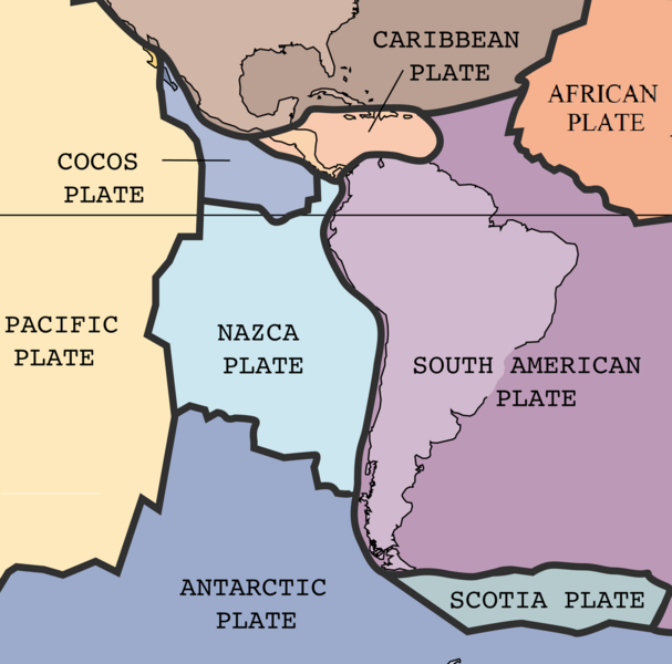
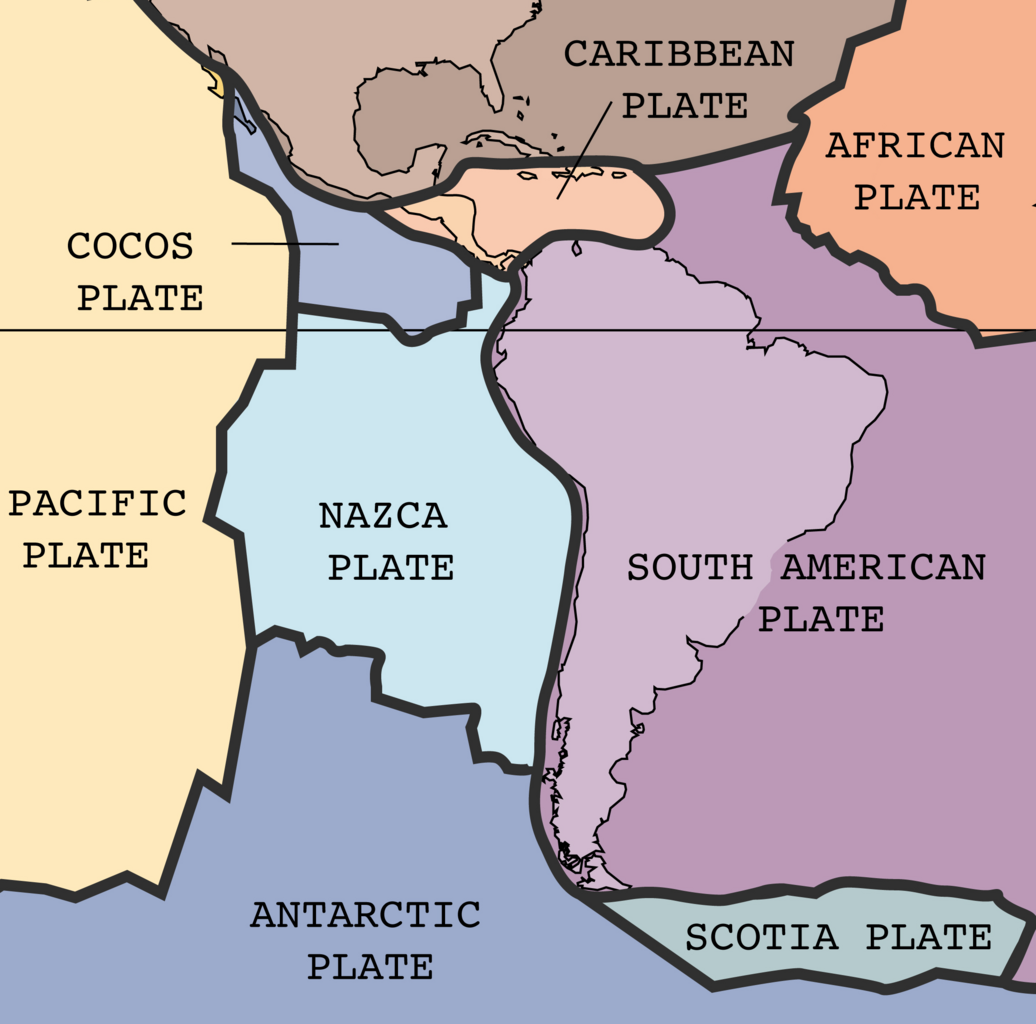
| विवरण | The key principle of plate tectonics is that the lithosphere exists as separate and distinct tectonic plates, which float on the fluid-like (visco-elastic solid) asthenosphere. The relative fluidity of the asthenosphere allows the tectonic plates to undergo motion in different directions. This map shows 15 of the largest plates. Note that the Indo-Australian Plate may be breaking apart into the Indian and Australian plates, which are shown separately on this map. |
| दिनांक | |
| स्रोत | http://pubs.usgs.gov/publications/text/slabs.html |
| लेखक | USGS; cropped by Beyond My Ken (talk) 10:06, 27 February 2010 (UTC) |
| दूसरे संस्करण |
|


This image is in the public domain in the United States because it only contains materials that originally came from the United States Geological Survey, an agency of the United States Department of the Interior. For more information, see the official USGS copyright policy.
|
फ़ाइल का इतिहास
फ़ाइलका पुराना अवतरण देखने के लिये दिनांक/समय पर क्लिक करें।
| दिनांक/समय | अंगूठाकार प्रारूप | आकार | प्रयोक्ता | प्रतिक्रिया | |
|---|---|---|---|---|---|
| वर्तमान | ००:१९, १ सितंबर २०२४ | | २,२८८ × २,२६१ (१,००५ KB) | wikimediacommons>RXFADEZ | restored Hispaniola to be a single island. Tried to preserve image format otherwise. Higher resolution |
फ़ाइल का उपयोग
निम्नलिखित पन्ने इस चित्र से जुडते हैं :