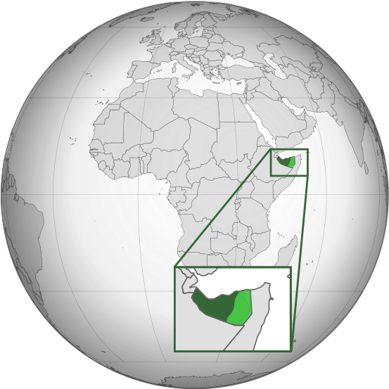
चित्र:Somaliland (orthographic projection).svg
नेविगेशन पर जाएँ
खोज पर जाएँ


पूर्वावलोकन PNG का आकार SVG फ़ाइल: ५५३ × ५५३ पिक्सेल अन्य resolutions: २४० × २४० पिक्सेल | ४८० × ४८० पिक्सेल | ७६८ × ७६८ पिक्सेल | १,०२४ × १,०२४ पिक्सेल | २,०४८ × २,०४८ पिक्सेल ।
मूल फ़ाइल (SVG फ़ाईल, साधारणत: ५५३ × ५५३ पीक्सेल्स, फ़ाईलका आकार: २७४ KB)
फ़ाइल का इतिहास
फ़ाइलका पुराना अवतरण देखने के लिये दिनांक/समय पर क्लिक करें।
| दिनांक/समय | अंगूठाकार प्रारूप | आकार | प्रयोक्ता | प्रतिक्रिया | |
|---|---|---|---|---|---|
| वर्तमान | ०९:१७, २८ मार्च २०२४ |  | ५५३ × ५५३ (२७४ KB) | wikimediacommons>Alaexis | I believe that this version is better; it simply marks the disputed area without saying who controls it; see these articles with similar maps https://www.economist.com/middle-east-and-africa/2021/05/06/somaliland-an-unrecognised-state-is-winning-friends-abroad https://www.thehindu.com/news/international/ethiopia-breakaway-somaliland-sign-port-deal-somalias-cabinet-calls-emergency-meet/article67697822.ece |
फ़ाइल का उपयोग
निम्नलिखित पन्ने इस चित्र से जुडते हैं :